Projects, chronologically:
Location Analysis for the Establishment of a Regional Medical Servive Centre (MVZ) in the Region Leinebergland (2019-2020)Analysis of the Provision of Facilities and Servives of Social and Cultural Infrastructure in the Planning Region Oberfranken-West (2019-2020) Functional Structure of Transport Networks Following the Central-Place Concept of the RIN for the Region Ostwürttemberg (2019)
Expertise for the Provision of Services of General Interest, in Particular the Definition of Central Places for Updating the Regional Plan of Main-Röhn (2018-2020)
Establishment of a Spatial Observation System for Adjacent Regions (2018-2020)
Regional Mobility Concept for the Ruhr Metropolis (2018-2019)
Analysis of the Provision of Facilities and Services of Social Infrastructure in the Planning Region of Regensburg (2018-2019)
Updating of the High-Resolution Population Disaggregation and Implementation of Accessibility Analyses in the Region of Ostwürttemberg (2018)
Analysis of the Provision of Facilities and Services of Social Infrastucture in the Planning Region of Oberpfalz-Nord (2017-2018)
Analysis of the Provision of Facilities and Services of Social Infrastructure in the Planning Region of Oberfranken-Ost (2017-2018)
Further Development of the Accessibility Analyses of BBSR (2017-2018)
Securing of Medical Services and Accessibility of Services of General Interest in the Leinebergland Region (2017-2018)
ESPON BT2050 – Territorial Scenarios for the Baltic Sea Region (2017-2018)
Accessibilities in the Baltic Sea Region (2017-2018)
Long-term Securing of Services and Mobility in Rural Regions (2016-2017)
SPESSARTregional: Development of a Regional Data Base (2016-2017)
Spatial Monitoring Germany and Neighbouring Regions (2015-2017)
Location and Accessibility Analysis of Health Services Provision – Mittelmosel (2014)
Accessibility Analysis for the Location of the Savings Bank Academy of NRW (2014)
Evaluation and Planning of Power Lines: Powerline Planning (2013-2016)
Ruhr Area 2050: Modelling the Energy Transition in the Ruhr Area (2013-2016)
Accessibility of Central Places in Mecklenburg-Vorpommern (2013)
Implementation of the Territorial Agenda 2020: TEN-T and TEN-E (2012-2014)
Impact Assessment of a Railway Tunnel between Helsinki and Tallinn (2012-2013)
Regional Services of General Interest (2012-2014)
Dissemination of ESPON in Germany (2011-2015)
ESPON TRACC: Transport Accessibility at Regional/Local Scale and Patterns in Europe (2010-2014)
Accessibility of Finnish Regions (2009-2010)
Schichten einer Region (2008-2011)
Accessibility of Essential Services in Bavaria (2008-2010)
Analysis of ESPON 2006 Results for Germany (2007-2008)
Accessibility Analysis of the Baltic Sea Region (2006)
Criteria for Adequate Service of Public Transport in North-Rhine Westphalia (2005-2007)
Accessibility Scenarios for the Rhine-Ruhr Metropolitan Region (2004-2005)
Impacts of Internalisation of External Costs of Transport in Saxony (2004-2005)
AlpenCorS: Modelling Regional Development in Alpen Corridor South (2004-2005)
Nordic Peripherality in Europe (2003-2004)
AsPIRE: Aspatial Peripherality, Innovation and the Rural Economy (2001-2004)
Location Analysis for the Establishment of a Regional Medical Service Centre (MVZ) in the Region Leinebergland (2019-2020)

The Region Leinebergland, a municipal association of several cities and municipalities in Lower Saxony, plans to establish a regional medical service centre (MVZ) maintained by the municipalities. S&W performs a location analysis for the production of recommendations for the localisation of the MVZ in the region, methodically based on scientifically objective and testable location criteria. The term location is understood in this expertise as geographical position, but not as concrete sites or already existing buildings.
Analysis of the Provision of Facilities and Servives of Social and Cultural Infrastructure in the Planning Region Oberfranken-West (2019-2020)
In the planning region Oberfranken-West the chapters "Kowledge, Education and Cultural Affairs" and "Social and Health Facilities" of the regional plan are to be updated. For this a survey and analysis of the state of municipal facilities are being conducted. Considering the demand for such facilities, their accessibilities and supply conditions as well as demographic and population structure, present and expected suppldy gaps and locations and their strategic importance for the provision of facilities close to residences will be identified as well as density centres with good accessibility as potential settlement centres. Based on the results policy measures for securing and improving of supply conditions are to developed and integrated as objectives and principles in the regional plan.
Functional Division of Transport Networks Following the Central-Place Concept of the RIN for the Region of Ostwürttemberg (2019)
In the course of the update of the regional plan of the region Ostwürttemberg a functional structure of the transport networks in the region following the Guidelines of Integrated Network Design (RIN) is to be derived from the central-place organisation of the region. The RIN describe a stragic transport network planning focussing not on individual measures but on the total transport network. The study will be conducted for the road network as well as for the cycling network and, besides the functional structure of the road network, consider also an evaluation of connective quality of the present travel supply between central places.
Expertise for the Provision of Services of General Interest, in Particular the Definition of Central Places for Updating the Regional Plan of Main-Röhn (2018-2020)
In the course of the adjustmnent of the regional plan to the current State Development Programme (§ 2 LEP) with the emphasis on services of general interest the Regional Planning Association Main-Rhön decided to update the regional plan chapter "Goals and Principles of Sustainable, Comprehensive Development of Spatial Structure" together in connection with the chapters "Social- und Health System" and "Transport". In this context S&W prepares an expertise, which will inform about the current and future situation of services of general interest in the region and about central-place possibilities to ensure the provision of services of general interest for the next 10 to 15 years. For this, under aspects of accessibility and capacity of services of general interest facilities current and possible gaps in the provision of services of general interest and existing locations and districts with special strategic importance for securing services of general interest in the region of Main-Rhön are identified and recommendations for the definition of central places and their local districts in the regional plan given.
Establishment of a Spatial Observation System for Adjacent Regions (2018-2020)
The spatial observation system of the Federal Institute for Research on Building, Urban Affairs and Spatial Development (BBSR) for Germany and Europe shall, according to the provision in the Spatial Development Law (Raumordnungsgesetz) in the medium term be complemented by a continuous reporting system about adjacent foreign regions. Whereas the previous spatial development model (MORO) project "Spatial Observation Germany and Adjacent Regions" still had a strictly exploratory character, with this MORO project "Establishment of a Spatial Observation System for Adjacent Regions" a continuous system of spatial observation is to be established. The objective of this project is the definition of the methodolical and technical principles for the establishment of a permanent spatial observation system for border regions at Federal level. The principles for the continuous cross-border spatial observation will be created with the cooperation of up to eight model regions.
Regional Mobility Concept for the Ruhr Metropolis (2018-2019)
![]() S&W is member of an international consortium led by the Dortmund transport planning consultancy
Planersocietät, which develops a regional
mobility concept for the Regional Association Ruhr (RVR):
The first topic of the poject is a comprehensive analysis of the mobility and transport situation in
the Ruhr Area. After that in cooperation with relevant actors central policy approaches for an
integrated mobility development concept will be developed, from which exemplary model
projects will be derived for implementation. The task of S&W is primarily the first-time elaboration
of a number of detailed accessibility analyses for the Ruhr Area, which in the context of further
analyses are to expose the strengths and weaknesses of the daily mobility conditions in the
Ruhr Area.
S&W is member of an international consortium led by the Dortmund transport planning consultancy
Planersocietät, which develops a regional
mobility concept for the Regional Association Ruhr (RVR):
The first topic of the poject is a comprehensive analysis of the mobility and transport situation in
the Ruhr Area. After that in cooperation with relevant actors central policy approaches for an
integrated mobility development concept will be developed, from which exemplary model
projects will be derived for implementation. The task of S&W is primarily the first-time elaboration
of a number of detailed accessibility analyses for the Ruhr Area, which in the context of further
analyses are to expose the strengths and weaknesses of the daily mobility conditions in the
Ruhr Area.
Analysis of the Provision of Facilities and Services of Social Infrastructure in the Planning Region of Regensburg (2018-2019)
In the Planning Region Regensburg the chapter of the regional plan "Social and Cultural Infrastructure" was newly edited. In the course of this S&W prepared an expertise analysing the provision of facilities and services of social infrastruture in the Planning Region Regensburg. The expertise contains a survey of the facilities and services of social infrastructure, standard maps, utilisation and demand analyses and more detailed accessibility analyses by car and public transport.
Updating of the High-Resolution Population Disaggregation and Implementation of Accessibility Analyses in the Region of Ostwürttemberg (2018)
The Regional Association Ostwürttemberg constructively deals with the changes and requirements of demographic development in order to develop strategies to ensure services of general interest and attractiveness, in particular in rural areas. S&W updated for this basic central information and planning data, which are used for updating the regional plan and in the KOMOBIL2035 project supported by the BMBF, in which future possibilities for securing mobility are developed. The work of S&W included a high-resolution population disaggregation for the years 2014 and 2035 and a comprehensive analysis of the accessibility of services of general interest by car, public transport, bicylce and walking and corresponding scenarios.
Analysis of the Provision of Facilities and Services of Social Infrastucture in the Planning Region of Oberpfalz-Nord (2017-2018)
In the Planning Region Oberpfalz-Nord the chapters of the Regional Plan B VI "Knowledge and Education, Cultural Affairs" and B VIII "Health and Social Affairs" were to be updated. In the course of this S&W prepared an expertise analysing the porvision of facilities and services of social infrastructure in the Planning Region Oberpfalz-Nord. The expertise contains an analysis of current facilities and services of social infrastructure, standard maps, utilisation and demand analyses and detailed accessibilty analyses by car and public transport.
Analysis of the Provision of Facilities and Services of Social Infrastructure in the Planning Region of Oberfranken-Ost (2017-2018)
In the Planning Region Oberfranken-Ost the chapters of the Regional Plan B VI "Knowledge and Education, Cultural Affairs" and B VIII "Health and Social Affairs" were to be updated. S&W supported the government of Oberfranken by the preparation of an expertise analysing the provision of facilities and services of cultural infrastructure in the Planning Region Oberfranken-Ost. The expertise contained an analysis of current facilities and services of social infrastructure, standard maps, utilisation and demand analyses and detailed accessibility analyses by car and public transport.
Further Development of the Accessibility Analyses of BBSR (2017-2018)
 The project
Further Development of Accessibility Analyses of BBSR is conducted as model project of spatial planning (MORO) for the Federal Institute for Research on Building, Urban Affairs and Spatial Development (BBSR). In the project the future-oriented and innovative approaches for the analysis and modelling transport and spatial accessibility existing among experts as well as possible new dta sources will be examined in order to derive conceptual, methodological and substantive strategic recommendations for the further development of the accessibility analyses of the
BBSR. The project is conducted under the leadership of S&W with the
Department of Freight Transport and Transport Logistics of the University of Wuppertal and
the research consultancy Scheiner (FBS) of Dortmund. More information is available on the
project page at the BBSR.
The project
Further Development of Accessibility Analyses of BBSR is conducted as model project of spatial planning (MORO) for the Federal Institute for Research on Building, Urban Affairs and Spatial Development (BBSR). In the project the future-oriented and innovative approaches for the analysis and modelling transport and spatial accessibility existing among experts as well as possible new dta sources will be examined in order to derive conceptual, methodological and substantive strategic recommendations for the further development of the accessibility analyses of the
BBSR. The project is conducted under the leadership of S&W with the
Department of Freight Transport and Transport Logistics of the University of Wuppertal and
the research consultancy Scheiner (FBS) of Dortmund. More information is available on the
project page at the BBSR.
Securing of Medical Services and Accessibility of Services of General Interest in the Leinebergland Region (2017-2018)
In a project funded by the Office of Regional Development of the Leine-Weser county the
Region of Leinebergland e.V., a municipal association of the cities of Alfeld (Leine) and Elze, the municiplaity of Leinebergland, the village of Delligsen and the municipalities of Freden (Leine), Lamspringe and Sibbesse, a regional strategy for securing medical services and bascíc infrastructure in Leinebergland is being developed. S&W supports the region by the collection of basic data as well as through analyses and scenarios of medical services and accessibility of services of general interest.
ESPON BT2050 – Territorial Scenarios for the Baltic Sea Region (2017-2018)
![]() In the project ESPON BT2050 – Territorial Scenarios for the Baltic Sea Region possible
spatial developments of the Baltic Sea Region are to be explored. The project aims at the identification of long-term
trends and their implications in the Baltic Sea Region and the develoment of three spatial scenarios based on these
trends. This includes a base scenario in which the most likely development path of the Baltic Sea Region is assumed,
and two contrasting scenarios in which through changes in several assumptions alternative spatial development paths
are explored. The project is conducted in close co-operation with stakeholders of the Baltic Sea Region. The project is
a co-operation with the Institute of Geography of the Polish Academy of Sciences (IGSO PAS) as lead partner, Nordregio
of Stockholm und Spatial Foresight of Luxemburg.
In the project ESPON BT2050 – Territorial Scenarios for the Baltic Sea Region possible
spatial developments of the Baltic Sea Region are to be explored. The project aims at the identification of long-term
trends and their implications in the Baltic Sea Region and the develoment of three spatial scenarios based on these
trends. This includes a base scenario in which the most likely development path of the Baltic Sea Region is assumed,
and two contrasting scenarios in which through changes in several assumptions alternative spatial development paths
are explored. The project is conducted in close co-operation with stakeholders of the Baltic Sea Region. The project is
a co-operation with the Institute of Geography of the Polish Academy of Sciences (IGSO PAS) as lead partner, Nordregio
of Stockholm und Spatial Foresight of Luxemburg.
Accessibilities in the Baltic Sea Region (2017-2018)
 The VASAB-Secretariat, the co-ordination office of the co-operation of the
ministries and agencies responsible for spatial planning and development in the countries bordering the Baltic Sea
and their neighbouring countries, has commisioned S&W to conduct a study on accessibilities in the Baltic Sea Region.
The goal is a comprehensive analysis, essentially based on previous studies, of the development so far and the
dynamics of accessibilities in the Baltic Sea Region for different transport modes and an assessment of the future
development to be expected through the completion of the trans-European networks.
The VASAB-Secretariat, the co-ordination office of the co-operation of the
ministries and agencies responsible for spatial planning and development in the countries bordering the Baltic Sea
and their neighbouring countries, has commisioned S&W to conduct a study on accessibilities in the Baltic Sea Region.
The goal is a comprehensive analysis, essentially based on previous studies, of the development so far and the
dynamics of accessibilities in the Baltic Sea Region for different transport modes and an assessment of the future
development to be expected through the completion of the trans-European networks.
Long-term Securing of Services and Mobility in Rural Regions (2016-2017)
 In the face of a declining and ageing population, changes in mobility and procurement behaviour and difficult financial
action spaces, innovative policies and approaches are needed to secure adequate local availability of public and
private services and their accessibility for all groups of society through needs-oriented mobility. The model project
Long-term Securing of Services and Mobility
in Rural Regions initiated by the Federal Ministry of Transport and Digital Infrastructure assists model regions
particularly affected by demographic change in addressing this theme intensively and developing anticipatory integrated
location and strategy concepts. S&W supports the rural counties Hildburghausen, Holzminden, Merzig-Wadern and
Sonneberg in developing their strategies by preparing for them the required information bases on the most likely
population development at the nighbourhood level.
In the face of a declining and ageing population, changes in mobility and procurement behaviour and difficult financial
action spaces, innovative policies and approaches are needed to secure adequate local availability of public and
private services and their accessibility for all groups of society through needs-oriented mobility. The model project
Long-term Securing of Services and Mobility
in Rural Regions initiated by the Federal Ministry of Transport and Digital Infrastructure assists model regions
particularly affected by demographic change in addressing this theme intensively and developing anticipatory integrated
location and strategy concepts. S&W supports the rural counties Hildburghausen, Holzminden, Merzig-Wadern and
Sonneberg in developing their strategies by preparing for them the required information bases on the most likely
population development at the nighbourhood level.
SPESSARTregional: Development of a Regional Data Base (2016-2017)
 The regional association Regionalverband SPESSARTregional has
participated in the action programme Regional Services
of General Interest of the Federal Ministry of Transport and Digital Infrastructure as one of 21 model regions.
During the development of the regional strategy and development concepts the value of specific regional
data, analyses and scenarios was recognised by municipalities, agencies and institutions as a fundamental precondition for
successfully coping with demographic change. In the project the information bases first implemented in the action programme,
such as small-scale assessment of population development, locations of services of general interest, mobility supply and
accessibility of facilities and accessibility scenarios, were updated by S&W and complemented by new aspects, such as
touristic destinations and importance of refugee immigration.
The regional association Regionalverband SPESSARTregional has
participated in the action programme Regional Services
of General Interest of the Federal Ministry of Transport and Digital Infrastructure as one of 21 model regions.
During the development of the regional strategy and development concepts the value of specific regional
data, analyses and scenarios was recognised by municipalities, agencies and institutions as a fundamental precondition for
successfully coping with demographic change. In the project the information bases first implemented in the action programme,
such as small-scale assessment of population development, locations of services of general interest, mobility supply and
accessibility of facilities and accessibility scenarios, were updated by S&W and complemented by new aspects, such as
touristic destinations and importance of refugee immigration.
Spatial Monitoring Germany and Neighbouring Regions (2015-2017)
![]() The project "Spatial Monitoring Germany and Neighbouring Regions" funded by the Demonstration Projects of Spatial
Planning (MORO) of the German government has the aim to develop recommendations for the implementation of
a permanent spatial monitoring system for German border regions and neighbouring regions. The core elements of the
project include the definition of a comprehensive catalogue of data requirements based on the experience in up to eight
model regions and existing cross-border analyses, the definition of a model catalogue of data and indicators for cross-border
spatial monitoring, a practical proof of utility through a prototype spatial observation report "Germany in Cross-border
Perspective" and the formulation of a road map for the implementation of the approach developed with particulatr attention
paid to the potential co-operation of the institutional actors. More details (in German) can be found on the
project website of the Federal Institute for Research on Building, Urban Affairs and Spatial Development
(BBSR).
The project "Spatial Monitoring Germany and Neighbouring Regions" funded by the Demonstration Projects of Spatial
Planning (MORO) of the German government has the aim to develop recommendations for the implementation of
a permanent spatial monitoring system for German border regions and neighbouring regions. The core elements of the
project include the definition of a comprehensive catalogue of data requirements based on the experience in up to eight
model regions and existing cross-border analyses, the definition of a model catalogue of data and indicators for cross-border
spatial monitoring, a practical proof of utility through a prototype spatial observation report "Germany in Cross-border
Perspective" and the formulation of a road map for the implementation of the approach developed with particulatr attention
paid to the potential co-operation of the institutional actors. More details (in German) can be found on the
project website of the Federal Institute for Research on Building, Urban Affairs and Spatial Development
(BBSR).
Location and Accessibility Analysis of Health Services Provision – Mittelmosel (2014)
 The Ministry of Interior, Sports and Infrastructure of the stae of Rhenania-Palatinate selected six model regions
for the Future Initiative "Strong Municipalities – Strong State".
In the model regions future tasks of local infrastructure are to be tackled through citizen participation and inter-municipality
co-operation. In the model region Mittelmosel the focus is on health and old-age care. In co-operation with the
entra Regionalentwicklung consultancy, S&W elaborated information on the current distribution of locations and
accessibility of health care facilities in the municipalities in the Mittelmosel region and showed scenarios of future
development.
The Ministry of Interior, Sports and Infrastructure of the stae of Rhenania-Palatinate selected six model regions
for the Future Initiative "Strong Municipalities – Strong State".
In the model regions future tasks of local infrastructure are to be tackled through citizen participation and inter-municipality
co-operation. In the model region Mittelmosel the focus is on health and old-age care. In co-operation with the
entra Regionalentwicklung consultancy, S&W elaborated information on the current distribution of locations and
accessibility of health care facilities in the municipalities in the Mittelmosel region and showed scenarios of future
development.
Accessibility Analysis for the Location of the Savings Bank Academy of NRW (2014)
 The two Saving Bank Academies in North-Rhine Westphalia, Westphalia-Lippe und Rhineland, were in early 2014
consolidated to become the Savings Bank Academy of North-Rhine Westphalia. The educarion and training currently
offered at Münster and Düsseldorf is to be performed at one single location in the future. This central location is
currently being sought through a competition. One essential criterion for this is good accessibility of the academy by
the participants and teaching staff by car and local and long-distance public transport. For this S&W conducted first
an analysis of the suitability of the 396 cities and municipalities of Norrth-Rhine Westphalia in terms of transport
accessibility for the Savings Bank Academy NRW. In a second phase the accessibility of a number of concrete l
ocations selected for further evaluation was conducted.
The two Saving Bank Academies in North-Rhine Westphalia, Westphalia-Lippe und Rhineland, were in early 2014
consolidated to become the Savings Bank Academy of North-Rhine Westphalia. The educarion and training currently
offered at Münster and Düsseldorf is to be performed at one single location in the future. This central location is
currently being sought through a competition. One essential criterion for this is good accessibility of the academy by
the participants and teaching staff by car and local and long-distance public transport. For this S&W conducted first
an analysis of the suitability of the 396 cities and municipalities of Norrth-Rhine Westphalia in terms of transport
accessibility for the Savings Bank Academy NRW. In a second phase the accessibility of a number of concrete l
ocations selected for further evaluation was conducted.
Evaluation and Planning of Power Lines: Power Line Planning (2013-2016)
![]() With the political decision for the energy transition in Germany it becomes necessary
to transport electricity over long distances and to develop for this topologically optimised
power networks and new power lines. This interdisciplinary research project aims at developing
sustainable concepts and methods for the objective multi-criteria evaluation and analysis of
network topologies and power line configurations. To support the power line planning, quantifiable
evaluation functions are to be developed, in which central, partially still uncertain topological,
planning, technical, economic, ecological and socioeconomic decision criteria are considered.
The three-year research and development project is funded by the Federal Ministy for Economy
and Technology (BMWI). S&W work in a consortium together with several chairs of TU Dortmund
University, such as the chairs "Graphical Systems" and "Algorithm Engineering" of the Faculty
of Computer Science, the chair "Discrete Optimisation" of the Faculty of Mathematics and the
chairs "Supply and Disposal Systems in Spatial Planning" and "Spatial Information Management
and Modelling" of the Faculty of Spatial Planning, as well as the power network operator
Amprion GmbH. More information about the project is available at the
project website.
With the political decision for the energy transition in Germany it becomes necessary
to transport electricity over long distances and to develop for this topologically optimised
power networks and new power lines. This interdisciplinary research project aims at developing
sustainable concepts and methods for the objective multi-criteria evaluation and analysis of
network topologies and power line configurations. To support the power line planning, quantifiable
evaluation functions are to be developed, in which central, partially still uncertain topological,
planning, technical, economic, ecological and socioeconomic decision criteria are considered.
The three-year research and development project is funded by the Federal Ministy for Economy
and Technology (BMWI). S&W work in a consortium together with several chairs of TU Dortmund
University, such as the chairs "Graphical Systems" and "Algorithm Engineering" of the Faculty
of Computer Science, the chair "Discrete Optimisation" of the Faculty of Mathematics and the
chairs "Supply and Disposal Systems in Spatial Planning" and "Spatial Information Management
and Modelling" of the Faculty of Spatial Planning, as well as the power network operator
Amprion GmbH. More information about the project is available at the
project website.
Ruhr Area 2050: Modelling the Energy Transition in the Ruhr Area (2013-2016)
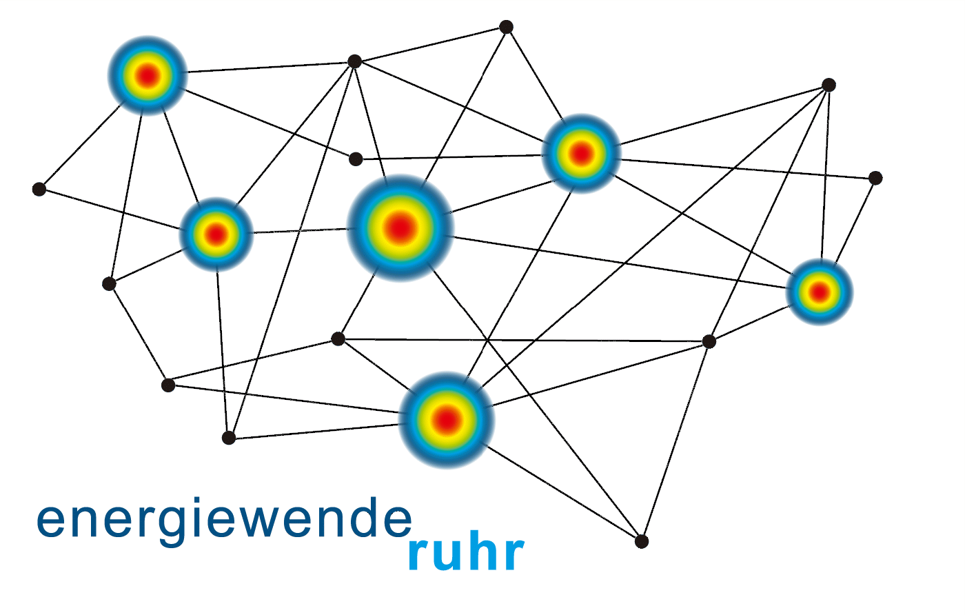
This project is part of the Framework Programme for the Implementation of the Energy Transition in the Municipalities of the Ruhr Area of the Stiftung Mercator to enhance knowledge and awareness of the need for and the challenges of the energy transition in the municipalities of the Ruhr Area by surveys, basic research projects, citizen participation and implementation studies. In it the IRPUD model of urban land, transport and environment so far applied to the Dortmund urban region will be extended to cover the whole Ruhr Area and to assess the impacts of land use, transport and other policies to reduce energy consumption and promote the transition to renewable energy on economy, mobility, quality of life and environment in the Ruhr Area until 2050. For this the model will be extended by submodels of renewable energy and energy efficiency of buildings and will be used to simulate scenarios that differ in their assumptions about future energy price increases and possible combinations of measures to reduce fossil energy consumption and to increase energy efficiency and renewable energy use to achieve the energy policy targets of the State of North-Rhine Westphalia. The project is a co-operation with the Wuppertal Institute for Climate, Environment and Energy and the Institute of Urban Studies & Sustainable Infrastructure Planning, University of Wuppertal. More information is available on the project page,
Accessibility of Central Places in Mecklenburg-Vorpommern (2013)
 The Federal State of Mecklenburg-Vorpommern is presently updating its state development
programme, in which accessibility plays a central role. For developing appropriate ways
of dealing with changing framework conditions, an analysis of the current accessibility
conditions by public transport, cycling and pedelecs as well as the combination of
bicycles and pedelecs is needed. The objective of this study funded by the State Ministry
of Energy, Infrastructure and Spatial Development is to obtain a precise picture of the
current accessibility conditions in the State using the transport modes mentioned above
and to evaluate these with the time thresholds of the Guidelines for Integrated Network
Design (RIN 2008). In concrete terms the accessibility of the central places from their
surrounding catchment areas, the accessibility of the central places with respect to each
other and the accessibility of the neighbouring larger centres outside of the Federal State
of Mecklenburg-Vorpommern are to be calculated, analysed and presented in tables
and visualised in maps.
The Federal State of Mecklenburg-Vorpommern is presently updating its state development
programme, in which accessibility plays a central role. For developing appropriate ways
of dealing with changing framework conditions, an analysis of the current accessibility
conditions by public transport, cycling and pedelecs as well as the combination of
bicycles and pedelecs is needed. The objective of this study funded by the State Ministry
of Energy, Infrastructure and Spatial Development is to obtain a precise picture of the
current accessibility conditions in the State using the transport modes mentioned above
and to evaluate these with the time thresholds of the Guidelines for Integrated Network
Design (RIN 2008). In concrete terms the accessibility of the central places from their
surrounding catchment areas, the accessibility of the central places with respect to each
other and the accessibility of the neighbouring larger centres outside of the Federal State
of Mecklenburg-Vorpommern are to be calculated, analysed and presented in tables
and visualised in maps.
Implementation of the Territorial Agenda 2020: TEN-T and TEN-E (2012-2014)

The project "Implementation of the Territorial Agenda 2020: Impacts of European Sectoral Policies in Selected Model Regions Development of Regional Potentials in Connection with the Development of the TEN-T und TEN-E" funded by the Spatial Planning Model Projects Programme (MORO) was to demonstrate for selected model regions possibilities how trans-European transport networks are compatible with national, trans-national and regional conditions and consider future spatial needs and challenges. The task of S&W in the project consisted in the assessment of the spatial and economic impacts of TEN-T on accessibility, economy and employment in the model regions using the regional economic model SASI. The project team consisted of Spatial Foresight Germany, Berlin and S&W. The Final Report of the project (so far only in German) is available at the website of the Federal Institute for Research on Building, Urban Affairs and Spatial Development.
Impact Assessment of a Railway Tunnel between Helsinki and Tallinn (2012-2013)
![]() The Aalto
University Department of Surveying and Planning, YTK Land Use Planning and Urban Studies Group
carried out the Central Baltic Interreg IVA project H-TTransPlan (Helsinki-Tallinn Transport and Planning
Scenarios). The objective of the contribution of S&W was to assess the impacts of a railway tunnel
between Helsinki and Tallinn on the development of the twin region Helsinki-Tallinn until 2050
considering EU-wide development conditions and external factors, such as the Russian economy,
using the
regional economic model SASI. In the assessment different scenarios of economic
development and different transport networks (tunnel link, Rail Baltica, other TEN-T projects)
were considered. The Report
of S&W ist available for download. More information can be found at the
INTERREG website of the project and the
Euregio website.
The Aalto
University Department of Surveying and Planning, YTK Land Use Planning and Urban Studies Group
carried out the Central Baltic Interreg IVA project H-TTransPlan (Helsinki-Tallinn Transport and Planning
Scenarios). The objective of the contribution of S&W was to assess the impacts of a railway tunnel
between Helsinki and Tallinn on the development of the twin region Helsinki-Tallinn until 2050
considering EU-wide development conditions and external factors, such as the Russian economy,
using the
regional economic model SASI. In the assessment different scenarios of economic
development and different transport networks (tunnel link, Rail Baltica, other TEN-T projects)
were considered. The Report
of S&W ist available for download. More information can be found at the
INTERREG website of the project and the
Euregio website.
Regional Services of General Interest (2012-2014)

The action programme on "Regional Services of General Interest", part of the Demonstration Projects of Spatial Planning (MORO) commissioned by the Federal Ministry of Transport and Digital Infrastructure, supported selected model regions in rural areas to address the infrastructural challenges of demographic change in an innovative manner by developing an appropriate regional strategy to adapt services of general interests. Within this action programme, S&W took over accompanying research on central data services. This included the coordination of data acquisition, processing and provision for the 21 selected model regions. For about half of the model regions, additional calculations and forecasts were performed to support the regional processes of strategy development. This comprised population forecasts and the generation of disaggregate population distributions to estimate demand potentials. Accessibility indicators were calculated to inform about the supply of different services for different user groups and to assess the accessibility consequences of optional regional strategies. A comparative analysis across all model regions concluded the project. The German-language Final Report of the contribution of S&W to the project is available for download. More English information is available on the project page and the MORO programme page on the website of the Federal Institute for Research on Building, Urban Affairs and Spatial Development (BBSR).
Dissemination of ESPON Results in Germany (2011-2015)
![]() Selected results of the ESPON Programme on spatial development in Europe are summarised in
German language and from a German perspective in a dissemination project for the Federal Institute
for Research on Building, Urban Affairs and Spatial Development (BBSR). The aim is to link ESPON
results to the national debate on spatial development and thus to strengthen the knowledge about
European spatial development in the scientific community, different political levels and also in
schools and universities. The results are published in six thematic information booklets.
Each of them is devoted to one thematic topic and based on the results of one or
several ESPON projects on that topic. The themes of the six booklets are:
(1) Energy and Climate,
(2)
Metropolitan Areas and Rural Regions,
(3)
Growth and Innovation,
(4)
Demographic Transition and Services of General Interest,
(5)
Accessibility and Spatial Development and
(6)
Spatial Scenarios for Europe 2050.
Selected results of the ESPON Programme on spatial development in Europe are summarised in
German language and from a German perspective in a dissemination project for the Federal Institute
for Research on Building, Urban Affairs and Spatial Development (BBSR). The aim is to link ESPON
results to the national debate on spatial development and thus to strengthen the knowledge about
European spatial development in the scientific community, different political levels and also in
schools and universities. The results are published in six thematic information booklets.
Each of them is devoted to one thematic topic and based on the results of one or
several ESPON projects on that topic. The themes of the six booklets are:
(1) Energy and Climate,
(2)
Metropolitan Areas and Rural Regions,
(3)
Growth and Innovation,
(4)
Demographic Transition and Services of General Interest,
(5)
Accessibility and Spatial Development and
(6)
Spatial Scenarios for Europe 2050.
ESPON TRACC: Transport Accessibility at Regional/Local Scale and Patterns in Europe
(2010-2014)
![]() The ESPON project TRACC (Transport Accessibility at Regional/Local Scale and Patterns
in Europe) aims at taking up and updating the results of existing studies on accessibility
at the European scale, to extend the range of accessibility indicators by further indicators
responding to new policy questions, to extend the spatial resolution of accessibility
indicators and to explore the likely impacts of policies at the European and national
scale to improve global, European and regional accessibility in the light of new challenges,
such as globalisation, energy scarcity and climate change. Project partners are the
Charles University of Prague, Czech Republic, RRG Spatial Planning and Geoinformation,
Oldenburg, Germany, Mcrit, Barcelona, Spain, the University of Oulu, Finland, TRT Trasporti
e Territorio, Milan, Italy and the Institute of Geography and Spatial Organisation of the
Polish Academy of Sciences, Warsaw, Poland. More information on the page
ESPON TRACC.
The ESPON project TRACC (Transport Accessibility at Regional/Local Scale and Patterns
in Europe) aims at taking up and updating the results of existing studies on accessibility
at the European scale, to extend the range of accessibility indicators by further indicators
responding to new policy questions, to extend the spatial resolution of accessibility
indicators and to explore the likely impacts of policies at the European and national
scale to improve global, European and regional accessibility in the light of new challenges,
such as globalisation, energy scarcity and climate change. Project partners are the
Charles University of Prague, Czech Republic, RRG Spatial Planning and Geoinformation,
Oldenburg, Germany, Mcrit, Barcelona, Spain, the University of Oulu, Finland, TRT Trasporti
e Territorio, Milan, Italy and the Institute of Geography and Spatial Organisation of the
Polish Academy of Sciences, Warsaw, Poland. More information on the page
ESPON TRACC.
Accessibility of Finnish Regions (2009-2010)
The objective of this study for the Regional Development Unit of the Finnish Ministry of Employment and the Economy was to provide accessibility indicators for all municipalities and regions of Finland. Based on detailed raster-based data for population and jobs different accessibility indicators were calculated. The accessibility of population and jobs were determined on the one hand taking only Finland into account and on the other by using all European regions as destinations. The indicators were calculated for the years 2001 and 2006, thus enabling an analysis of the spatial dynamics.
Schichten einer Region (Layers of a Region) (2008-2011)
This project directed by the Chair of Urban Design of the Techical University of Dortmund aimed at producing an annotated atlas of urban form and spatial sturcture of the Ruhr Area. The topic areas of the atlas were selected with a planning orientation: location and size of the Ruhr Area, settlement structure, mobility, ethnic and social mosaic, landscape, structural change and governance spaces. Assessment and interpretation used a unified visual language in maps complemented by diagrams and explanatory texts. The work was focused towards a concluding interpretative chapter with a main map illustrating the planning perspectives of the Ruhr Area. The model to follow of the project was the study Die Schweiz. Ein städtebauliches Portrait of the Studio Basel of the ETH Zürich. The results of the project were published in the book Schichten einer Region. Kartenstücke zur räumlichen Struktur des Ruhrgebiets (in German).
Accessibility of Essential Services in Bavaria (2008-2010)
Objective of this project for the Bavarian Ministry of Economic Affairs, Infrastructure, Transport and Technology was to analyse at which locations in Bavaria different services exist and how accessible they are by different population groups. The project contributed to an assessment of the central place system in Bavaria. The first work package consisted of the capture, geocoding and analysis of the spatial distribution of facilities of basic needs (primary and lower secondary schools, physicians, dentists, pharmacies, banks, post and police, shops) and higher needs (higher secondary schools, tax authorities, employment centres, hospitals). Based on this, an analysis of the accessibility of these facilities by car and by public transport for different population groups was performed. This analysis was based on a disaggregation of the Bavarian population to raster cells of 100 x 100 m size and a database of all streets and public transport lines developed in the project. The work was carried out in co-operation with RRG Spatial Planning and Geoinformation, Oldenburg i.H., Germany.
Analysis of ESPON 2006 Results for Germany (2007-2008)
In the project for the Federal Ministry of Transport, Building and Urban Affairs (BMVBS) the results of the ESPON 2006 Programme were reviewed from a German perspective. The results of the project were communicated in a series of reports and workshops with politicians and scientists from Germany. The work was carried out in co-operation with the Federal Office for Building and Regional Planning (BBR). Partners in the project were the Institute for Regional Development and Structural Planning (IRS) as Lead Partner and raumkom, Trier, and Spatial Foresight, Luxembourg. The Final Report was published in the research series of the BBR.
Accessibility Analysis of the Baltic Sea Region (2006)
 The objective of this study was to provide an up-to-date picture of the accessibility situation of the Baltic Sea
Region through a set of appropriate indicators as background information for the preparation of the Baltic Sea
Region Transnational Programme 2007-2013. The "internal and external accessibility of the Baltic Sea Region"
is one of the four priorities of the programme. The study was commissioned by the
Joint Technical Secretariat of the Baltic Sea Region INTERREG III B
Programme. The work was carried out in co-operation with RRG Spatial Planning and Geoinformation,
Oldenburg i.H., Germany. The Final Report can be
downloaded.
The objective of this study was to provide an up-to-date picture of the accessibility situation of the Baltic Sea
Region through a set of appropriate indicators as background information for the preparation of the Baltic Sea
Region Transnational Programme 2007-2013. The "internal and external accessibility of the Baltic Sea Region"
is one of the four priorities of the programme. The study was commissioned by the
Joint Technical Secretariat of the Baltic Sea Region INTERREG III B
Programme. The work was carried out in co-operation with RRG Spatial Planning and Geoinformation,
Oldenburg i.H., Germany. The Final Report can be
downloaded.
Criteria for Adequate Service of Public Transport in North-Rhine Westphalia (2005-2007)
The project for the Ministry for Buildung and Transport of the state of North-Rhine Wetphalia aimed at developing criteria for adequate service of public transport and, based on these criteria, proposing alternative rules for the allocation of public transport subsidies in North-Rhine Westphalia and forecasting the likely impacts of the new allocation rules on mobility, accessibility and the environment. To do this, on the supply side settlement patterns and traffic flows and on the demand side the existing level of service of public transport were analysed. Based on these results, six different allocation rules were presented and compared. In addition to proposing two of them, S&W calculated the state-wide accessibility impacts of all six allocation rules and, using the eastern Ruhr area as an example, forecast their regional impacts with the IRPUD model. The project was a co-operation of S&W with the universities of Wuppertal und Münster under the direction of the Institute of Urban Studies and Sustainable Infrastructure Planning of the University of Wuppertal. The Final Report of the project (in German) is available for download.
Accessibility Scenarios for the Rhine-Ruhr Metropolitan Region (2004-2005)
This project was to complement the project "Analysis of Central Constraints, Instruments and Goal Criteria for State Transport Planning in North-Rhine Westphalia" conducted by the Institut für Landes- und Stadtentwicklungsforschung und Bauwesen (ILS) for the Ministry for Transport, Energy and Regional Planning of the state of North-Rhine Westphalia by accessibility modelling. For this, subregions of the Rhine-Ruhr area (municipalities and districts of larger cities) were assessed regarding their accessibility by different transport modes. Current accessibility potentials were calculated and possible impacts on accessibility of strategic scenarios of transport infrastructure development were assessed. The Final Report of the project (in German) can be downloaded.
Impacts of Internalisation of External Costs of Transport in Saxony (2004-2005)
The objective of the project "Impacts of Internalisation of External Costs of Transport in Saxony" was to explore possibilities to reduce the environmental impacts of transport in Saxony by prinicng as well as supporting other policies and to assess their effects. S&W was to forecast the economic impacts of two policies, a CO2 surcharge on fuel prices and a cordon charge for the major cities of Dresden, Leipzig und Chemnitz, on the regions in Saxony, compared to one another and to the regions in the rest of Germany with the SASI model. The project was a co-operation with the Chair of Transport Ecology of the Technical University of Dresden and RRG Spatial Planning and Geoinformation, Oldenburg i.H., Germany. The Final Report by S&W and the Final Report of the total project (both in German) are available for download.
AlpenCorS: Modelling Regional Development in Alpen Corridor South (2004-2005)
 The Interreg III B programme "Alpine Space" (2000-2006) aimed at the dvelopment of a political concept for the
pan-European Corridor V between France, Italy, Slovenia and Austria as a common strategey for economic and
spatial development. The project AlpenCorS ("Alpen Corridor South") focused on the central segment of the
Corridors south of the Alps. The sub-project reported here was to assess the effects of the implementation of
the intersection between Corridor V and Corridor I, the Brenner Corridor, the most important transalpine
north-south link between the AlpenCorS regions and the central European regions north of the Alps. The task
of S&W in AlpenCorS was, in co-operation with RRG Spatial Planning and Geoinformation, Oldeburg i.H.,
Germany, to simulate the impacts of different transport policy options for the Brenner Corridor on
accessibility and regional economic development with the
SASI model. The results of the model contributed to a broader Territorial Impact Assessment
by the Dipartimento di Ingegneria Gestionale of the Politecnico di Milano for the Provincia Autonoma di Trento.
The Final Report by S&W for AlpenCorS
is available for download.
The Interreg III B programme "Alpine Space" (2000-2006) aimed at the dvelopment of a political concept for the
pan-European Corridor V between France, Italy, Slovenia and Austria as a common strategey for economic and
spatial development. The project AlpenCorS ("Alpen Corridor South") focused on the central segment of the
Corridors south of the Alps. The sub-project reported here was to assess the effects of the implementation of
the intersection between Corridor V and Corridor I, the Brenner Corridor, the most important transalpine
north-south link between the AlpenCorS regions and the central European regions north of the Alps. The task
of S&W in AlpenCorS was, in co-operation with RRG Spatial Planning and Geoinformation, Oldeburg i.H.,
Germany, to simulate the impacts of different transport policy options for the Brenner Corridor on
accessibility and regional economic development with the
SASI model. The results of the model contributed to a broader Territorial Impact Assessment
by the Dipartimento di Ingegneria Gestionale of the Politecnico di Milano for the Provincia Autonoma di Trento.
The Final Report by S&W for AlpenCorS
is available for download.
Nordic Peripherality in Europe (2003-2004)
 The objective of the study commissioned by the "NERP-EU" Committee of the Nordic Council of Ministers
was to assess the peripherality of Nordic regions using accessibility indicators. Specifically, the study was
to illustrate differences in travel cost throughout Europe and to show the degree of peripherality of NUTS-3 regions
in the whole of Europe and, with higher spatial resolution, for municipalities (NUTS-5) in the Nordic countries.
The work was carried out in co-operation with Nordregio – Nordic Centre for Spatial Development, Stockholm.
The
Final Report can be downloaded from the Nordregio
website.
The objective of the study commissioned by the "NERP-EU" Committee of the Nordic Council of Ministers
was to assess the peripherality of Nordic regions using accessibility indicators. Specifically, the study was
to illustrate differences in travel cost throughout Europe and to show the degree of peripherality of NUTS-3 regions
in the whole of Europe and, with higher spatial resolution, for municipalities (NUTS-5) in the Nordic countries.
The work was carried out in co-operation with Nordregio – Nordic Centre for Spatial Development, Stockholm.
The
Final Report can be downloaded from the Nordregio
website.
AsPIRE: Aspatial Peripherality, Innovation and the Rural Economy (2001-2004)
 The term "aspatial peripherality" indicates regional deficits which are often associated with peripheral
location but can also appear in centrally located regions. In a time when physical distance or travel
cost are less and less restrictions to economic activity, such deficits as insufficient utilisation of
new information and communication technologies or poor networks between local firms,
development agencies and markets are becoming more and more important for central as for
peripheral regions. The project AsPIRE ("Aspatial Peripherality, Innovation and the Rural Economy")
was to define the term "aspatial peripherality", to develop a method to measure it using regional
indicators and to make recommendations how to overcome it. AsPIRE was a co-operation of partners
from seven countries under the co-ordination of the Rural Policy Group of the Scottish Agricultural
College in Aberdeen, United Kingdom. S&W collaborated in the project with the Institute of Spatial
Planning of the University of Dortmund (IRPUD). The
Final Report is available for download. A project report by IRPUD and S&W,
Aspatial Peripherality in Europe, is available on the
IRPUD homepage.
The term "aspatial peripherality" indicates regional deficits which are often associated with peripheral
location but can also appear in centrally located regions. In a time when physical distance or travel
cost are less and less restrictions to economic activity, such deficits as insufficient utilisation of
new information and communication technologies or poor networks between local firms,
development agencies and markets are becoming more and more important for central as for
peripheral regions. The project AsPIRE ("Aspatial Peripherality, Innovation and the Rural Economy")
was to define the term "aspatial peripherality", to develop a method to measure it using regional
indicators and to make recommendations how to overcome it. AsPIRE was a co-operation of partners
from seven countries under the co-ordination of the Rural Policy Group of the Scottish Agricultural
College in Aberdeen, United Kingdom. S&W collaborated in the project with the Institute of Spatial
Planning of the University of Dortmund (IRPUD). The
Final Report is available for download. A project report by IRPUD and S&W,
Aspatial Peripherality in Europe, is available on the
IRPUD homepage.