Tools and Models

Our special competence lies in spatial analysis and simulation, geographic information systems and advanced visualisation techniques. Our tools and models for spatial modeling, analysis and optimisation are continuously being further developed, so we always apply state-of-the-art methods for spatial analysis and data processing.

Our tools und models enable an early consideration of realistic possibilities, limits and consequences of spatial development and planning processes. Most models are scalable both spatially and in terms of content. Thus, our tools and models are solution-oriented to the respective study area and the specific purpose of a study.


Accessibility Models

Accessibility Models

The accessibility models by S&W are among the most recognised models of their kind in Europe due to their theoretical foundation, practical and political relevance and their visualisation techniques. They are used at all spatial levels (including cross-border) from the local to the regional, ...

Population Projection

Population Projection

S&W has a long experience in the development and application of demographic forecast models. Population and household forecast models are central components of dynamic spatial development simulations such as the IRPUD or ILUMASS model. S&W's demographic forecast models are continuously ...

Public Transport Module

Public Transport Module

The public transport module enables an uncomplicated integration of digital timetable data into the accessibility analyses with S&W's accessibility models. It is used at all spatial levels from municipal to regional, national and European scales. Basically, the public transport module is ...

Population Disaggregation Model

Population Disaggregation Model

For the development and implementation of a target-oriented adaptation strategy for the different areas of technical and social infrastructure and services, small-scale information on the age-structural development of the population and the resulting change in demand is required. With the ...

Scenario Analyses

Scenario Analyses

By analysing scenarios, the effects of different planning measures can be estimated before they are implemented. What-if analyses enable well-founded, comparative assessments and simplify decision-making processes. The interactions between population development, spatial structure and mobility ...

IRPUD Model

IRPUD Model

The IRPUD model is a dynamic simulation model of intraregional location and mobility decisions in an urban region. It was developed in a project for the German Research Council at the Institute of Spatial Planning of the University of Dortmund and has been applied in several projects for the ...

ILUMASS Model

ILUMASS Model

The ILUMASS model is an integrated, completely microscopic simulation model of land use, transport and environmental impacts in urban regions. It was developd in the ILUMASS project (Integrated Land Use Modeling and Transportation System Simulation) funded by the Federal Ministry of Education and ...

SASI Model

SASI Model

The regional economic model SASI was developed by the partners of S&W in co-operation with the Technical University of Vienna in the EU project SASI (Spatial and Socio-economic Impacts of Transport Investments and Transport System Improvements). The model has since been applied in several EU ...

Raster Model

Raster Model

The Raster model is a disaggregate model of environmental impacts of urban land use and transport. It was developed in the EU project PROPOLIS (Planning and Research of Policies for Land Use and Transport for Increasing Urban Sustainability). Combined with a land-use transport model as the IRPUD ...

Time-Space Maps

Time-Space Maps

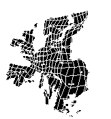
Modern transport technologies reduce the time to overcome space; measured in units of time, space is 'shrinking'. Time-space maps represent this interaction between space and time cartographically. In time-space maps the distance between two points is not proportional to their physical distance (as ...